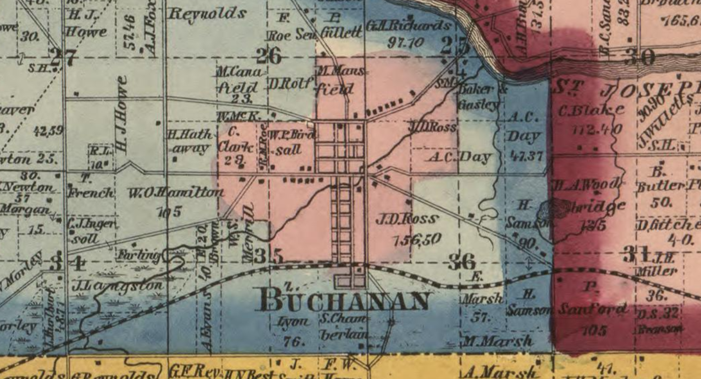
Introducing the past
Buchanan stands in the ancestral homeland of the Potawatomi and Miami peoples. Nearby Fort St. Joseph, in present-day Niles, grew from a French Jesuit mission established in the 1680s into a trading post where French and Native communities lived and traded. The fort came under British control in 1761.
Congress created the Northwest Territory in 1787. Michigan became a separate territory in 1805, during Thomas Jefferson’s presidency. Settlers established the community that became Buchanan in the 1830s, amid federal policies that dispossessed Native peoples, including the Indian Removal Act of 1830 and the Treaty of Chicago of 1833. The Pokagon Potawatomi secured the right to remain in Michigan, and their descendants continue to live in the region today.
1. Front & Main Streets
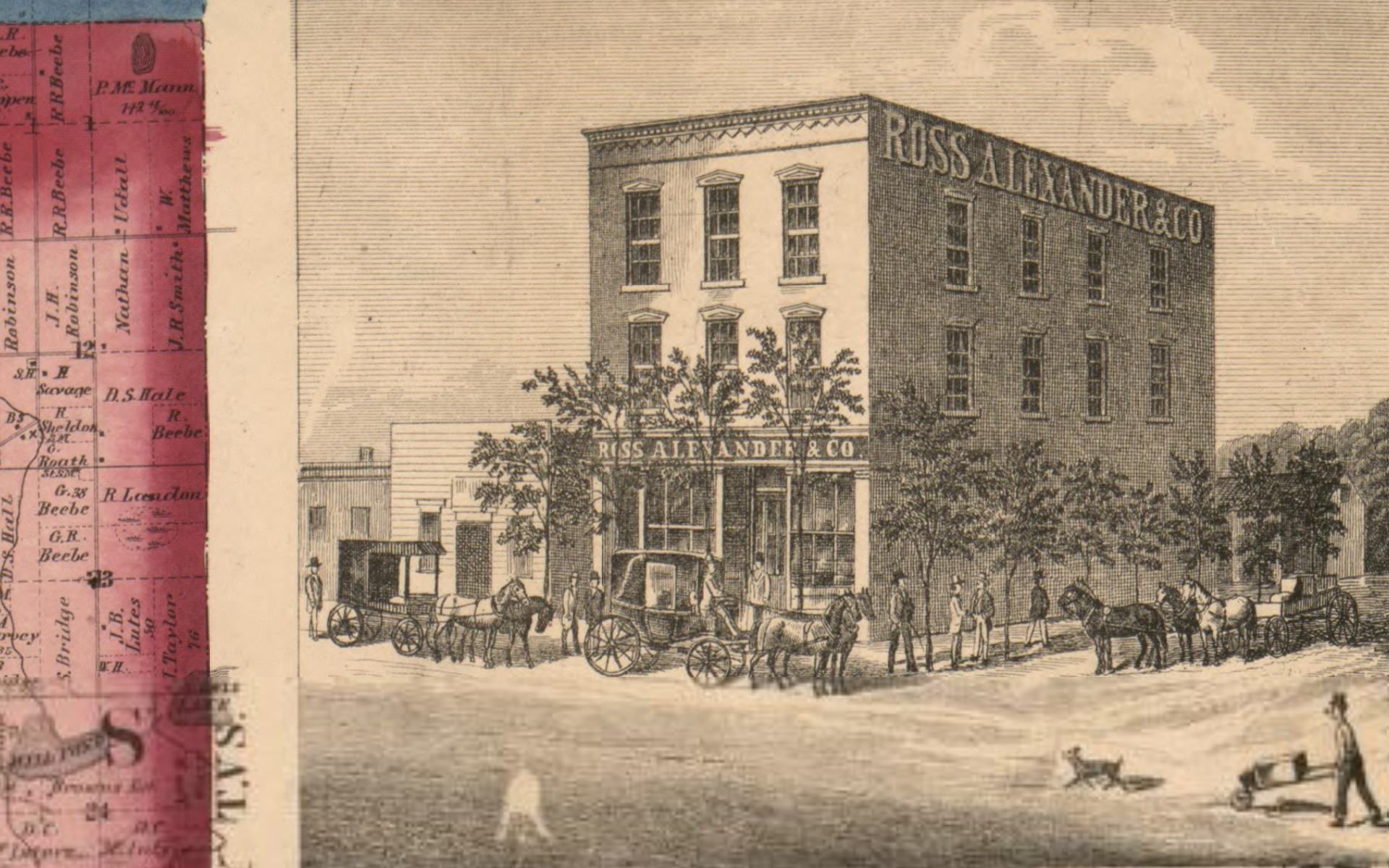
Begin at Front and Main Streets, the historic heart of Buchanan, where commerce grew alongside water-powered industry. The Great Fire of 1862 devastated much of downtown, including Ross and Alexander’s Excelsior Block. The Union Block, begun in 1862 and completed in 1863, survived the fire while under construction. Its arched upper windows are a reminder of the Italianate brick architecture that came to define Front Street.
2. Front Street storefronts
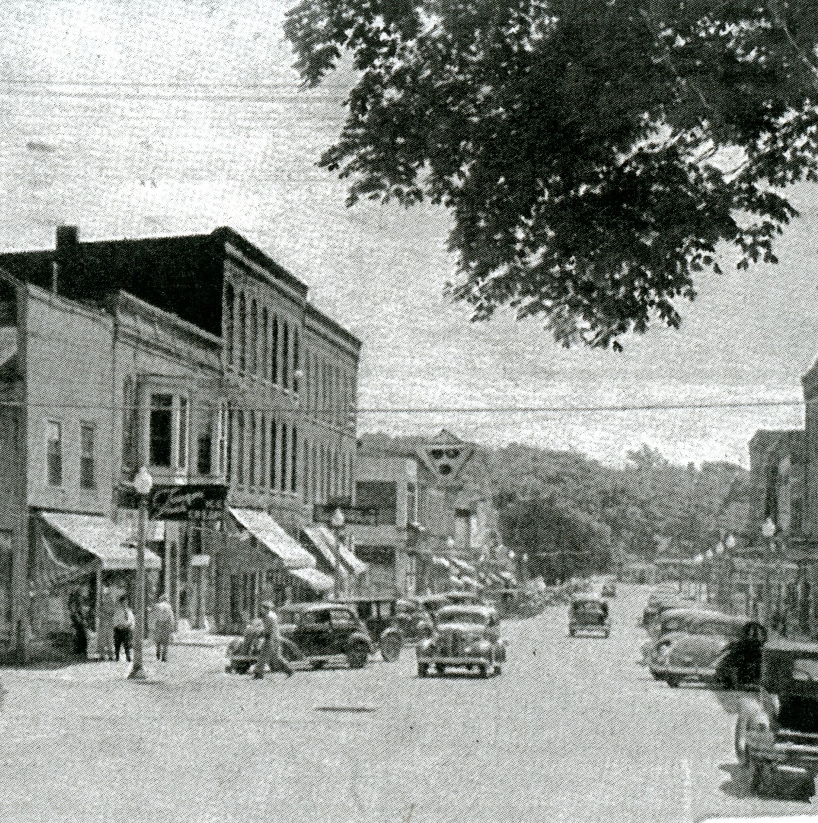
Walk east along Front Street and look at the upper floors as well as the storefronts. The block from 201 to 219 East Front Street tells the story of a working town: banks, shops, restaurants and gathering places, with new businesses carrying on behind historic façades.
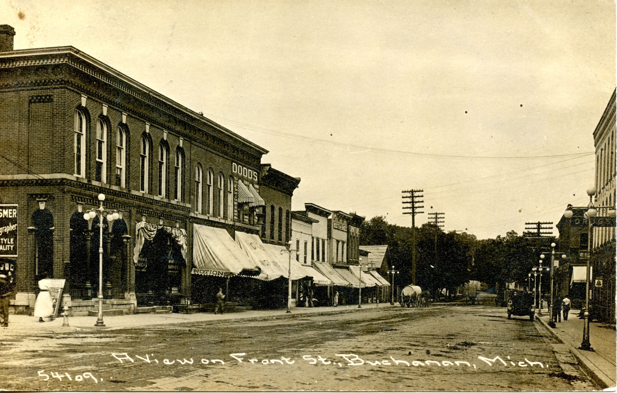
At the northeast corner of Front and Main Streets, Ross and Fulton’s bank building was constructed in 1866, after the fire. It later housed the First National Bank. The neighboring building also served as a bank, including Lee Brothers Bank. Farther along the block, drugstores, sweet shops, tailors and saloons served successive generations of Buchanan residents.
Continue as far as Days Avenue, then turn back west along Front Street to Mill Alley. Use the marked street crossings as you explore both sides of the block.
3. Pears Mill & the millrace
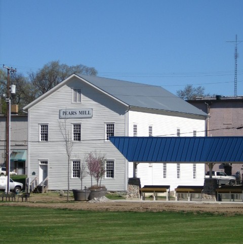
Follow Mill Alley, dedicated in 1856 as an access route to the mill, south from Front Street to Pears Mill. Built in 1857–58, the flour mill drew its power from a millrace dug in the 1840s. This engineered channel diverts water from McCoy Creek, carries it through town to the mill, and rejoins the creek through an underground tailrace near Days Avenue.
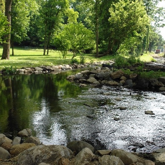
Water is essential to Buchanan’s story. McCoy Creek drops roughly sixty feet on its way to the St. Joseph River, providing power for flour mills, sawmills and other workshops throughout the nineteenth century.
According to the Buchanan Preservation Society’s account of the 1860 census, Pears Mill was then Berrien County’s largest industrial enterprise. It processed 170,000 bushels of wheat into 40,000 barrels of flour, with the flour valued at approximately $240,000. The surviving mill brings that history within reach.
4. The Common & McCoy Creek
From Pears Mill, continue toward the Common and Days Avenue. The millrace and McCoy Creek connect Buchanan’s industrial history with the open spaces where the town gathers today. The Farmers’ Market, summer concerts and Tin Shop Theater give you reasons to pause along the way.
For a street-side approach to the Common, use Days Avenue. For the downtown loop, return north on Days Avenue to Front Street, then walk west to Main Street. Circle back to Front Street for another shop, a meal or a drink.
The Clark lands
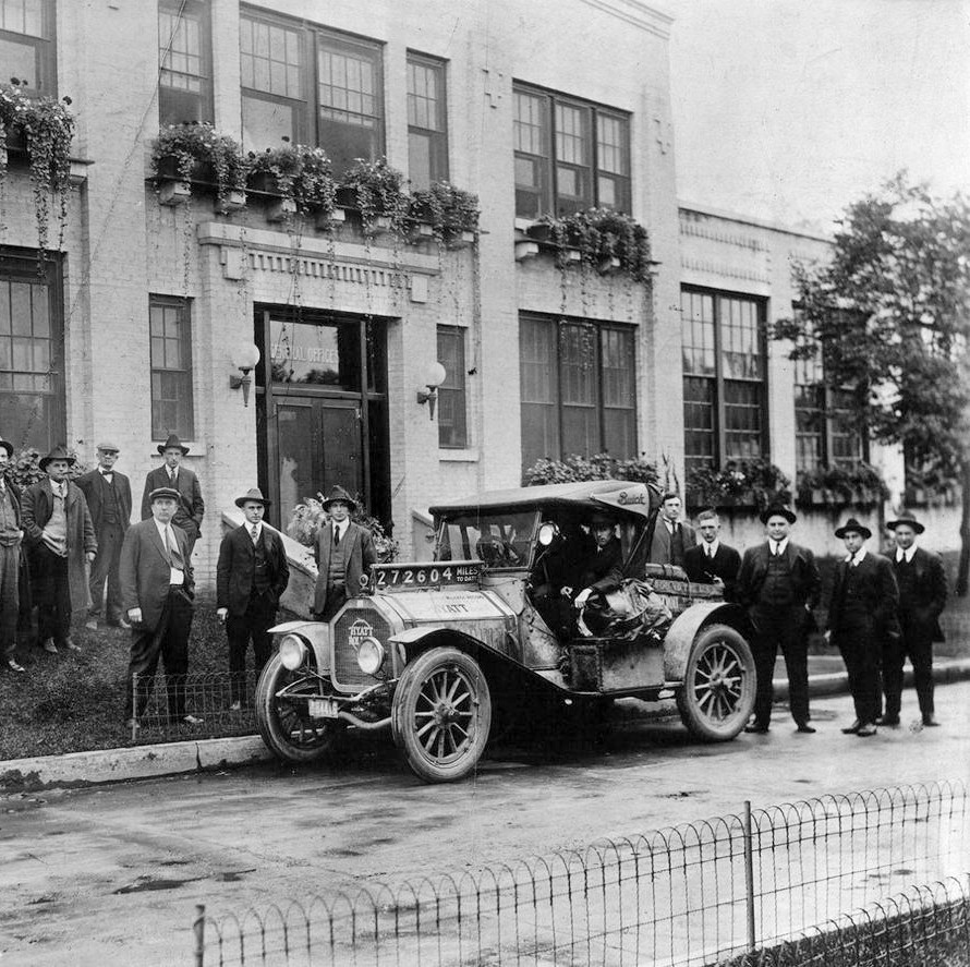
Clark Equipment grew from earlier Buchanan manufacturers. The company’s own history dates its formation to the January 1917 merger of the Celfor Tool Company and the Buchanan Electric Steel Company. That year, workers built a powered shop vehicle to move materials around the Buchanan plant—an early step in the development of the modern forklift.
Clark became a Fortune 200 company and a major employer whose growth shaped Buchanan for much of the twentieth century. The loss of manufacturing operations brought profound change to the town. Much of the former factory complex was later demolished, including buildings on River Street in 2012.
The former headquarters, testing laboratory and personnel office survive in the Clark Equipment Company Administrative Complex Historic District, just east of downtown. The complex, including 324 East Dewey Street, offers a different chapter in the story: historic industrial buildings finding new uses.
To visit the surviving buildings, use the public sidewalks to East Dewey Street. View the complex from the street and respect private entrances. Return west along Dewey Street, then south on Main Street to Front Street.
McCoy Creek Trail
Extend your visit along McCoy’s Creek Trail, a shared-use path through the landscape that helped shape Buchanan. The city describes the trail as extending from E.B. Clark Woods on Schirmer Parkway to the Buchanan Farmers’ Market, with loops, creek overlooks and access points along the way. It extends onward to the southwest to the Bakertown Fen.
Join the trail from the Days Avenue access point downtown. A walk along the creek connects the town’s industrial past with its quieter natural surroundings. Look for the history mural near Smith and Oak Streets, or continue toward the Duck Pond for a place to pause.
Choose an out-and-back walk from Days Avenue, then return to Front Street. Trail surfaces and access vary; consult the city’s trail information when planning a route with a wheelchair, stroller or other mobility needs.